8 Hikes in Sonoma County for the Adventurous
From fields of wildflowers to views of the rugged California coast, Sonoma County offers a wealth of scenic hikes, ranging from easy to strenuous. Here we highlight some of the most challenging trails, ranked based on distance and gain, with information on alternate routes, parking and day use fees.
Sea to Sky Trail (Jenner Headlands Preserve)
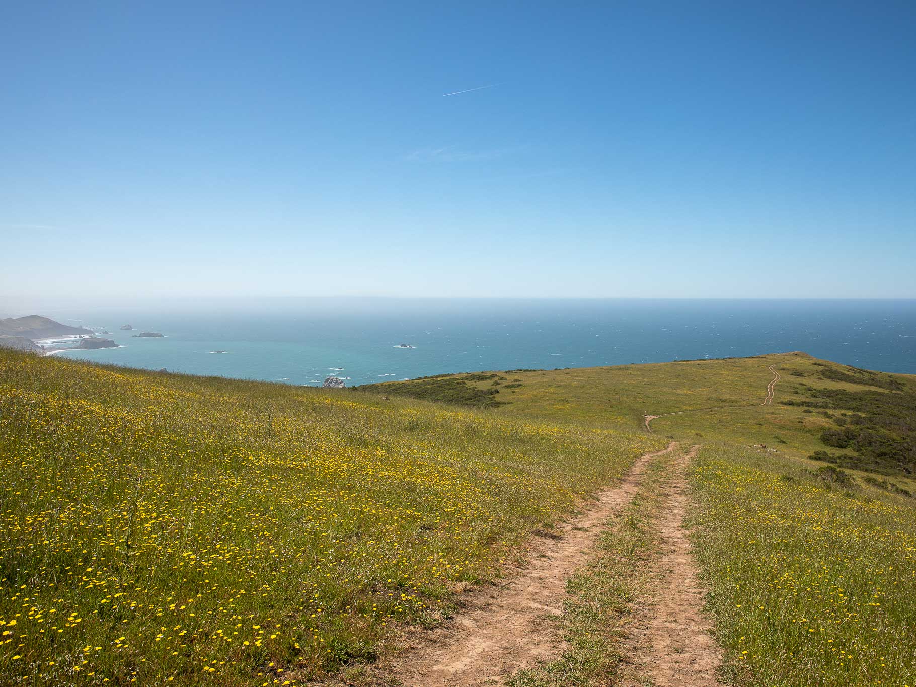
FAST FACTS: 15 miles, 3,600 feet of elevation gain. Parking is free, and Jenner (a five-minute drive) is the closest town with services.
The Sea to Sky Trail is considered one of the most difficult hikes in Sonoma County — and one of the most rewarding. The first two and a half miles climb nearly 1,000 feet through a meadow with spectacular views of the coast, and the next two miles descend 800 feet through the forest. Over the next three miles, the trail ascends 1,800 feet to Pole Mountain, the high point of the Sonoma Coast. While this out-and-back hike has some shaded sections, a fair amount of it is exposed to the sun, so consider getting an early start and bringing plenty of water.
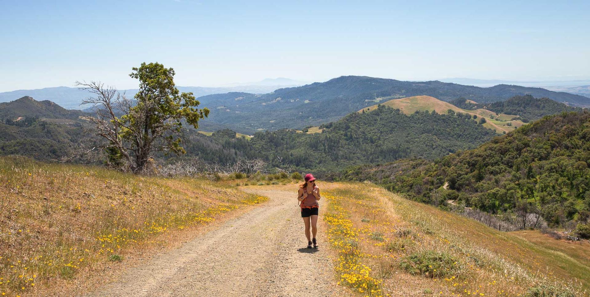
Mount Saint Helena Trail (Robert Louis Stevenson State Park)

FAST FACTS: 10 miles, 2,000 feet of gain. Parking is free, and Calistoga (a 15-minute drive) is the closest town with services.
At 4,342 feet, Mount Saint Helena is the high point of Sonoma County, and the route to the summit is the definition of gradual gain. The hike begins on the Stevenson Memorial Trail, which is narrow with a handful of rocky spots. Just before the one-mile mark, turn left on the Mount Saint Helena Trail, which is a graded fire road. (And don’t forget this junction on the way back, because the turn for the Stevenson Memorial Trail isn’t well marked.) The rest of the ascent features long, gentle switchbacks (pictured above), and be prepared for some wind when you reach the top. While the views are phenomenal, it should be noted that there are radio towers at the summit, and hikers may occasionally have to share the road with service vehicles.
North Sonoma Mountain Ridge Trail (North Sonoma Mountain Regional Park and Open Space Preserve)
FAST FACTS: 8 miles, 1,200 feet of gain. Parking is $7, or free for Sonoma County Regional Parks members. Santa Rosa (a 20-minute drive) is the closest town with services.
The North Sonoma Mountain Ridge Trail is a fantastic out-and-back option for those seeking a long-distance jaunt with steady gain. The first mile meanders mostly through a wildflower-filled meadow, and the Bennett Valley Overlook is just after the mile-and-a-half mark. From there, the trail climbs through the trees, and into Jack London State Park. This trail is part of the much longer Bay Area Ridge Trail, which, per the Sonoma County Parks website, is “an evolving effort to create 550 miles of continuous public trail” in the San Francisco Bay Area.
Bald Mountain via Bald Mountain Trail (Sugarloaf Ridge State Park)
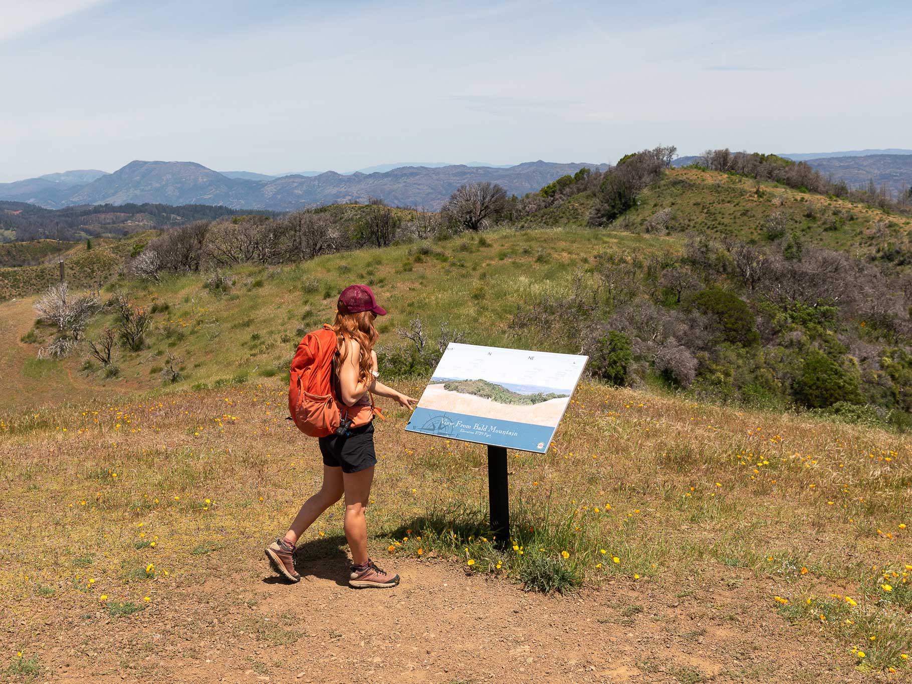
FAST FACTS: 5 miles, 1,500 feet of gain. Day use is $10, and annual passes for Sugarloaf Ridge and Jack London State Parks are $49. California State Park passes, which can be purchased online, are also accepted. Kenwood (a 15-minute drive) is the closest town with services.
In the spring and early summer, hikers are rewarded with a carpet of California poppies next to the Bald Mountain Trail, and numerous park benches sit along the moderate out-and-back route. The first mile is a well-maintained, single-track trail, and just after the one-mile mark, the route becomes paved. The last third of the trail is a gravel road, with yet another park bench at the summit. Those wishing to add more distance and gain can make a partial loop via the Gray Pine and Vista Trail back to the same trailhead, adding an extra mile and a half and 200 feet of gain.
Taylor Mountain via Western Route and Sky Lupine Trail (Taylor Mountain Regional Park)
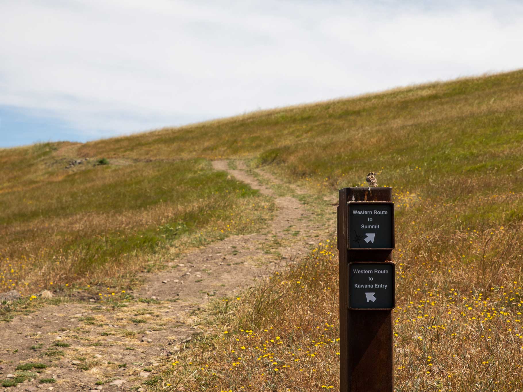
FAST FACTS: 5 miles, 1,200 feet of gain (via Petaluma Hill trailhead). Parking is $7, or free for Sonoma County Regional Parks members. Santa Rosa (a five-minute drive) is the closest town with services.
Taylor Mountain is accessible via the Kawana Terrace and Petaluma Hill trailheads, both of which use the Western Route to the summit. The Taylor Mountain trail network features ample signage to ensure hikers don’t get turned around, but it’s worth paying close attention, as there are numerous junctions. A handful of areas near the Western and Lupine trails are closed, so it’s also important for hikers to skip shortcuts (aka “social trails”) that may impact habitat restoration efforts. Most of these spots are marked with orange mesh fencing and A-frame signs, but some routes posted on popular user-generated hiking apps run right through the closed areas, so please follow common sense when it comes to staying on established trails. The gain is gradual, and the terrain is a mix of open meadows and woodland habitat. Hikers will pass through several cattle gates, and while dogs are allowed, they are required to be leashed.
Bummer Peak Trail (Lake Sonoma Recreation Area)
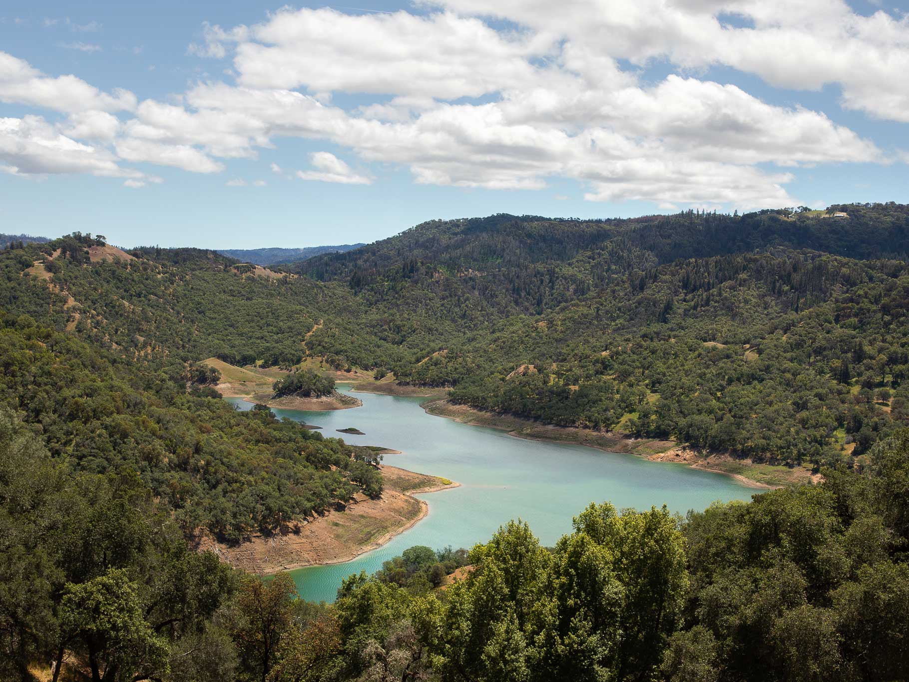
FAST FACTS: 5 miles, 1,150 feet of gain. Parking is free, but for those wishing to backcountry camp, sites run $20 per night and are reservable on recreation.gov. Geyserville (a 15-minute drive) is the closest town with services.
For hikers seeking solitude and unique vistas in Sonoma County, consider the trek to Bummer Peak. The out-and-back trail can be accessed from the Little Flat trailhead, but hikers can reduce the distance (and avoid crossing Rockpile Road) by parking at the Lake Sonoma boat launch lot. The trail starts at the very southeastern corner of the lot, and it’s not particularly well marked, though the route on AllTrails is accurate. The vegetation is thick along the first section of the single-track trail, so consider wearing pants and boots, and be mindful of ticks. Crowley’s Lake View Trail, which loops around the summit, offers fabulous views of Lake Sonoma (pictured above), and just to the south of the trail are the two backcountry campsites, along with a pair of porta potties.
Ridge Trail via Pond and South Ridge Trail (Shiloh Ranch Regional Park)
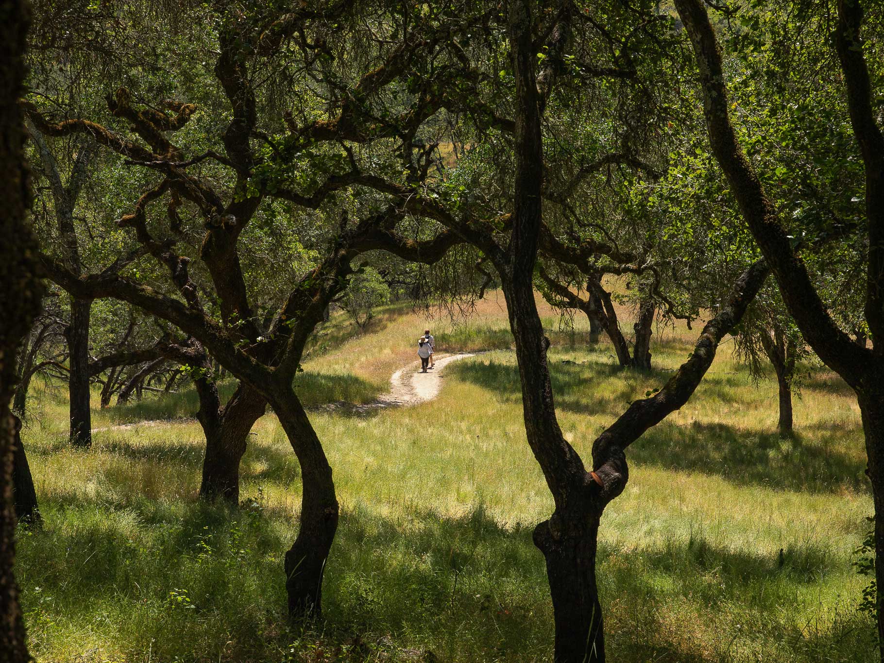
FAST FACTS: 4.5 miles, 1,000 feet of gain. Parking is $7, or free for Sonoma County Regional Parks members. Windsor (a 10-minute drive) is the closest town with services.
The trail network in Shiloh Ranch Regional Park offers multiple routes for the Ridge Trail, all of which boast gorgeous woodland scenery. Many of the trails are former ranch roads, so they are wide and well-maintained. After logging a mile on the Ridge Trail, turn left to stay on the Pond Trail, and after half a mile or so, veer right on the Mark West Creek Trail. After a quarter of a mile, stay right on the Canyon Trail, which runs a little over a mile before meeting back up with the Ridge Trail. The trail is a steady mix of up and down, gaining about 500 feet in the first mile, dropping 400 feet by the two-and-a-half-mile mark, and finishing up with a similar amount of ascent and descent in the last two miles.
Warren Richardson Trail (Trione-Annadel State Park)
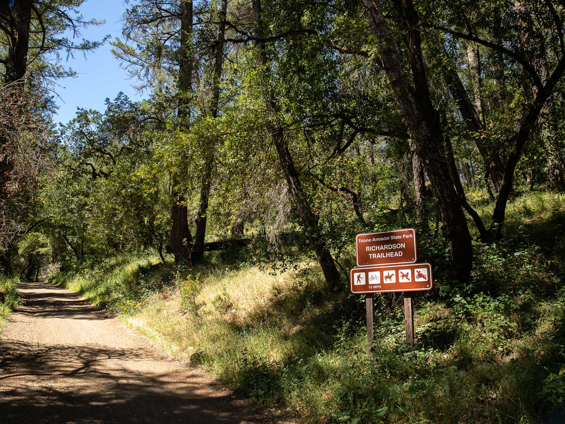
FAST FACTS: 5 miles, 800 feet of gain. For those who do not have an annual California State Parks pass, parking for day use is $7. Santa Rosa (a 15-minute drive) is the closest town with services.
The Warren Richardson Trail is a popular multi-use trail, and the out-and-back route is wide enough to accommodate hikers, mountain bikers and equestrians. The first two miles climb approximately 600 feet, and the next half mile dips down about 200 feet to Lake Ilsanjo, which is the perfect spot for a picnic. After retracing your steps and regaining the slight loss in elevation, the return to the trailhead is a mellow descent through trees and meadows. Several areas along the trail are closed for habitat restoration, so please remember to stick to established routes.
For more information about recreating responsibly, read Your Guide to Sustainable Hiking in Sonoma County.
Written by Sonoma Insider Elisabeth Brentano; all photos courtesy of Elisabeth Brentano